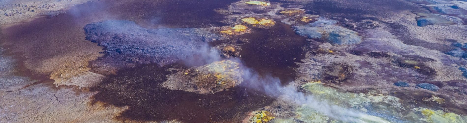
Dallol lies in the north of the Danakil Depression, in the Afar Region of northeastern Ethiopia.
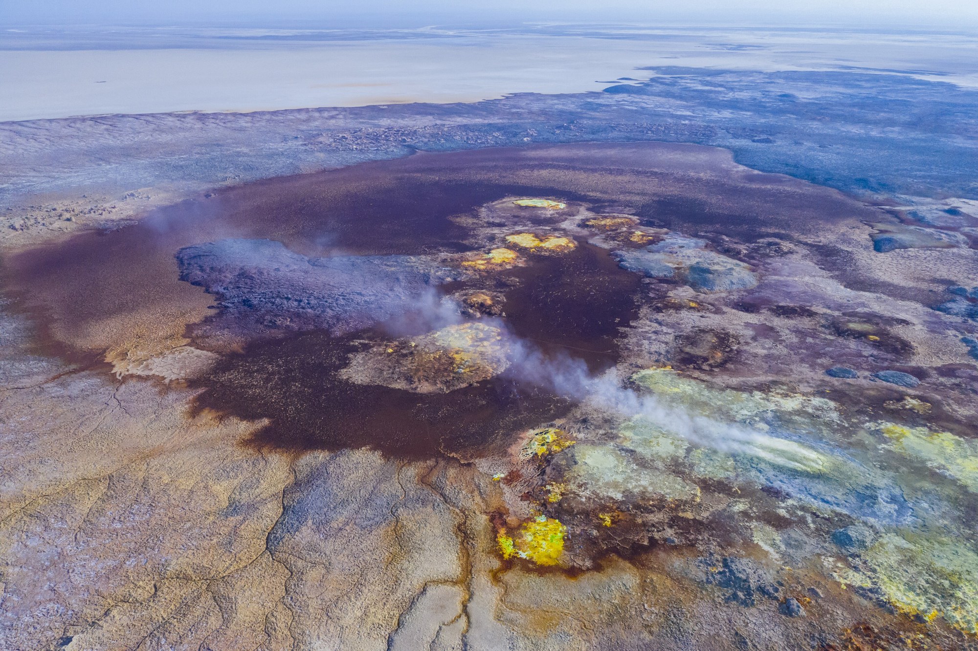
In a 2019 study in Nature Ecology and Evolution, Jodie Belilla and colleagues describe it as a dome raised about 40 metres above a basin floor that sits roughly 120 metres below sea level. The basin, some 200 kilometres long, belongs to the Afar rift, where the Nubian, Somalian and Arabian plates meet. The authors note that Dallol shows no volcanic rock at the surface, yet it gives off gas constantly and is dotted with hot springs.
A volcano made of salt
The ground here is salt left behind by the sea. A 2022 paper in ACS Earth and Space Chemistry by Fermín Otálora and colleagues says the Danakil salt plain covers about 4,000 square kilometres. It formed as seawater from the Red Sea flooded the depression again and again through the Gulf of Zula, in present day Eritrea, building up a layer of evaporites 2.2 kilometres thick. The authors put the dome at 2.5 to 3.5 kilometres across, with a round hollow at its centre. In their model, heat from basaltic magma pushed in beneath the salt drove water out of buried minerals. The rock swelled and domed upward, then partly collapsed into a caldera. The result, they argue, has the craters, flows and vents of a volcano, all made of salt.
Colours from iron
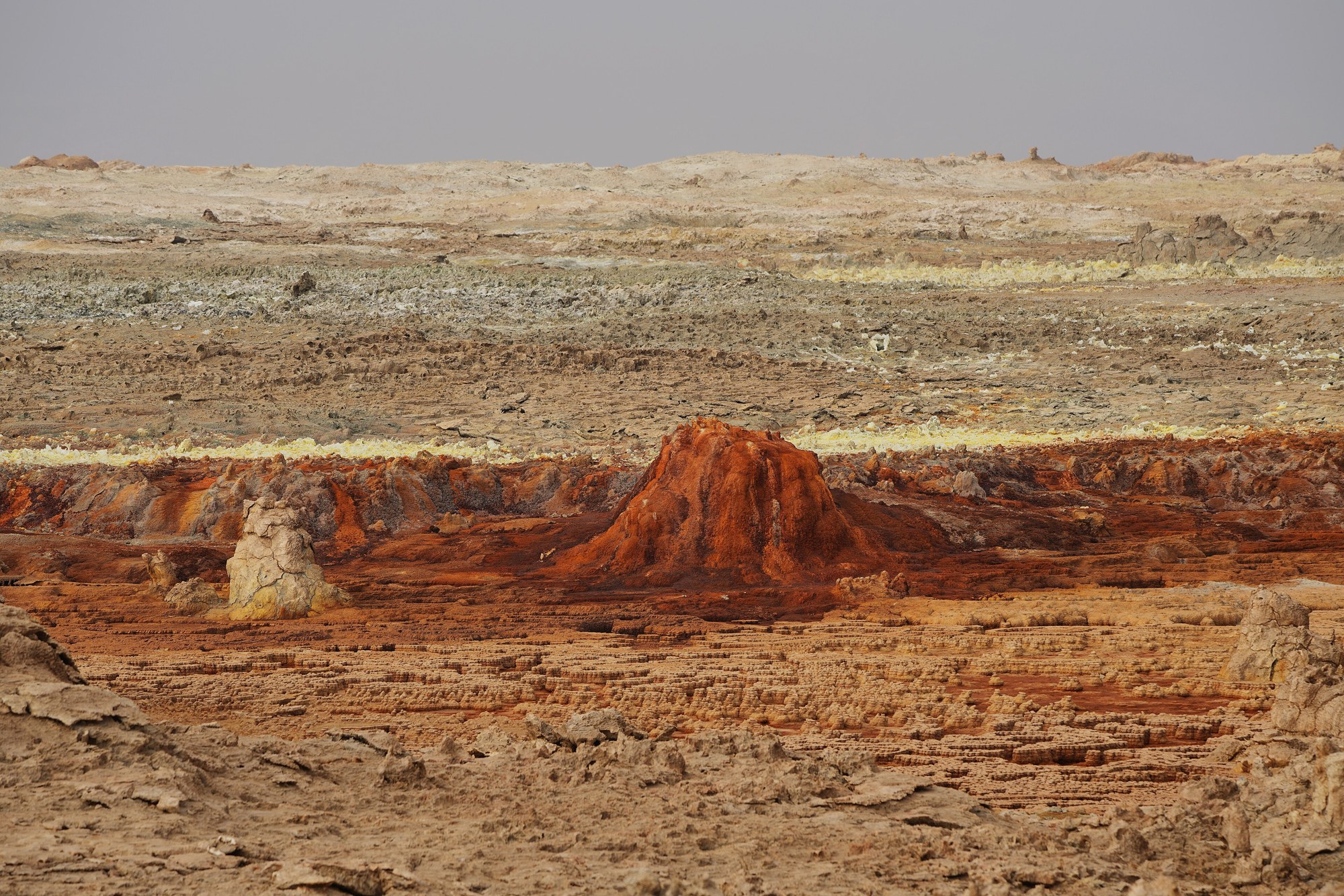
The yellows, greens and reds come from chemistry, not from living things. Writing in the same journal in 2019, Electra Kotopoulou and colleagues reported spring water at 108 °C, saturated with salt and free of oxygen, with pH values from 0.1 down to minus 1.7 and up to 150 grams of iron per litre. As the brine meets the air, they found, its dissolved iron slowly oxidises, so the deposits shift from white to green, then yellow and finally red. They identify the pillars standing around the site as the remains of springs that have stopped flowing.
Belilla and her team looked for microbes across the area. Their results strongly suggest that no active life survives in the hot, hyperacidic ponds on the dome or in the nearby Black and Yellow lakes. In milder salty pools close by, however, they found a striking diversity of very small archaea.
Potash, a railway and a mining town
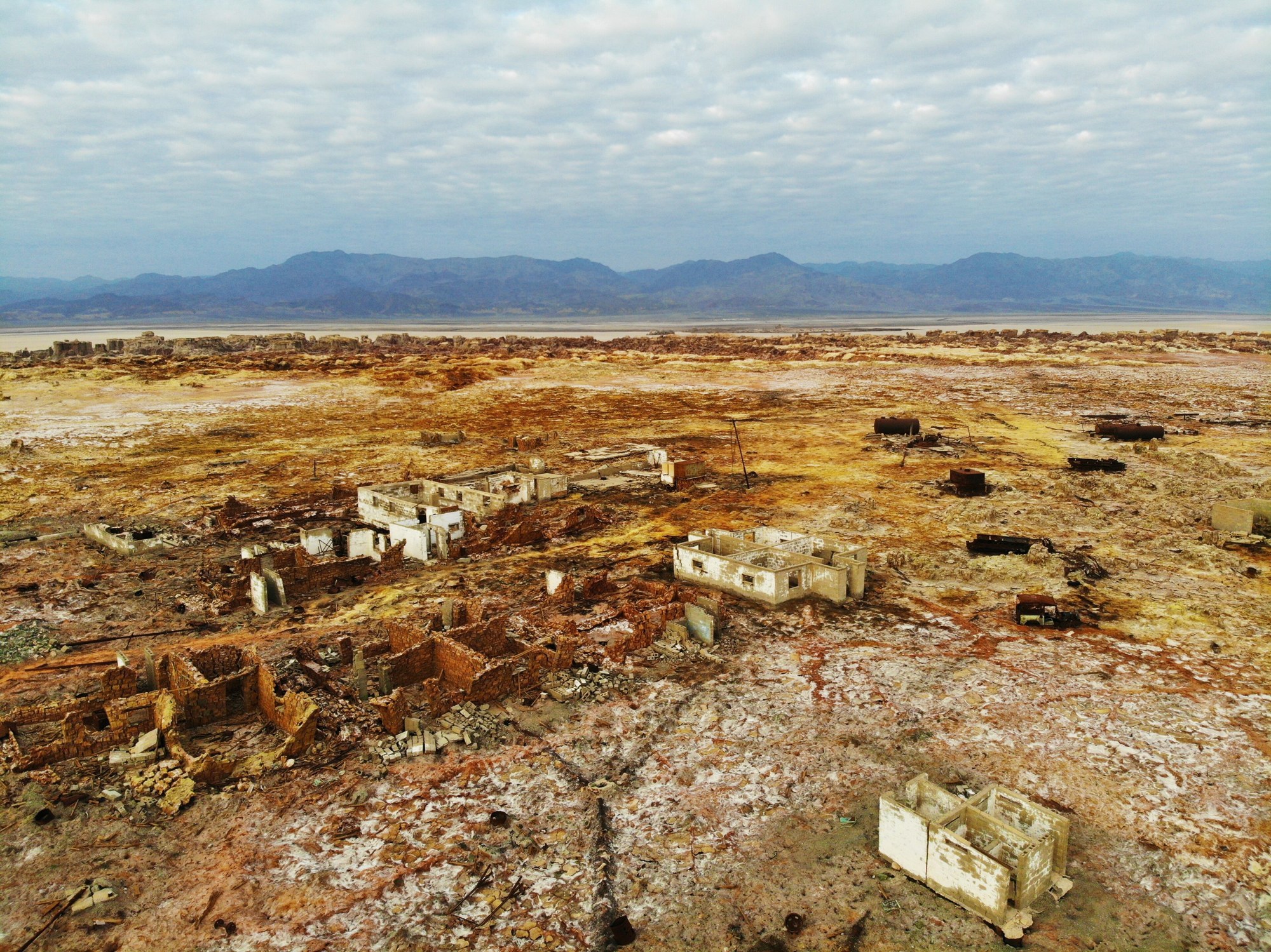
The salt also drew miners. The Italian colonial history site Italia Coloniale recounts that the brothers Adriano and Tullio Pastori won an Ethiopian concession in 1912 to prospect and mine 50 square kilometres for 35 years, and that it passed in 1917 to the Compagnia Mineraria Coloniale. With the First World War cutting off potash from Germany and Russia, the company dug some 51,000 tonnes of ore in a few years, and another 25,000 tonnes of sylvite between 1925 and 1929. A narrow gauge railway, opened in April 1918, ran about 65 kilometres inland from the small Red Sea port of Mersa Fatma, with trucks carrying the ore over the last stretch to Dallol.
According to the volcano reference site Photovolcanica, which draws on a 1968 study in Economic Geology by James Holwerda and Richard Hutchinson, the American Ralph M. Parsons Company took up the area’s potash in 1954. It set up its base on the site of the old Italian settlement and drilled more than 300 holes to trace the potash beds.
Sources
- Jodie Belilla and colleagues, Hyperdiverse archaea near life limits at the polyextreme geothermal Dallol area, Nature Ecology and Evolution 3, 2019
- Fermín Otálora, Fernando Palero, Evgenia-Maria Papaslioti and Juan Manuel García-Ruiz, Mineralochemical Mechanism for the Formation of Salt Volcanoes: The Case of Mount Dallol (Afar Triangle, Ethiopia), ACS Earth and Space Chemistry 6, 2022
- Electra Kotopoulou and colleagues, A Polyextreme Hydrothermal System Controlled by Iron: The Case of Dallol at the Afar Triangle, ACS Earth and Space Chemistry 3, 2019
- Italia Coloniale: La Compagnia Mineraria Coloniale e la ferrovia della Dancalia (2020)
- Photovolcanica: Dallol Volcano
- James G. Holwerda and Richard W. Hutchinson, Potash-bearing evaporites in the Danakil area, Ethiopia, Economic Geology 63 (2), 1968